

Object Record
Images
Metadata
Catalog Number |
1996.002.029 |
Object Name |
Map |
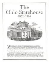
Title |
Self guided map |
Date |
1996 |
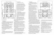
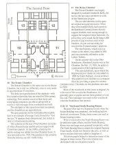
Description |
This map was used as a self-guided tour option for Ohio Statehouse visitors. The cover depicts a line drawing of the Statehouse and a brief description about the history and construction of the building. Inside, there are maps of each floor with descriptions of the areas that visitors would see during their exploration of the Statehouse. |
Dimensions |
H-11 W-8.5 inches |
Material |
Paper/Ink |
Provenance |
This map was found in the collection of the Ohio Statehouse Museum Education Center. The Capitol Square Review and Advisory Board took over the care of the Statehouse and its collections in 1988. |
Search Terms |
Ohio Statehouse |
Subjects |
History Maps Touring Tourists |